https://opengeofiction.net/#map=15/-38.6161/143.1671

America's waterways are extremely heavily controlled- both through the actual waterway itself and levees, quays, riprap, and embankments on their shores. Remembering the laws of nature- avoiding bifurcations (well, almost always) and flowing according to geometric meander patterns, will only get you so far in the modern world. Except in the rare case of connected river basins, as with the Orinoco and Amazon rivers in South America, river transit is made possible through a complicated system of canals. Portage, or hauling ships overland, is often achieved through lock and dam systems, but these systems are also present in navigable river to provide electricity while maintaining navigability. Huge rivers such as the Mississippi have complicated flood and river control mechanisms- which in Louisiana have ended up causing problems with downstream erosion, flooding huge amounts of the state. When poorly designed, they damage ecosystems, both in and around the river.
For Nenova, the Akogama provides essential port access as well as basic resources, especially water, waterpower, and sewage. But like many rivers, it also poses a risk, both existential and constant, of flooding. Some towns, such as Rochester, manage this risk by using flood dams, but this is impossible here- where navigability is a necessity and the topography is too flat to allow for such a dam, as it would flood the countryside. That means that flood control is largely moved to the local level. There's an embankment (levee) behind the rail line that protects all the buildings, which is very tall and makes high approaches a necessity. Extreme examples, such as Ottawa (KS), have levees over 10 feet tall. These are significant engineering projects usually undertaken by the U.S. government, but maintenance is done by the municipality.
Closer to the river, there are areas of riprap, artificial chunks of stone or concrete that line the riverbank to protect it from erosion. Erosion is a serious problem with a controlled river- one that means industrial areas are usually protected with quays and urban beaches are rare. If you have been to the riverside in a city, or a protected narrow peninsula, there's a fair chance that you've seen riprap before- though it's often thought of as a natural river shore. Rocky river shores do exist, but they are marked largely by natural slopes, smaller, round rocks, and rocky riverbeds. These rivers are often smaller and cannot carry their rocks along, at least quickly.
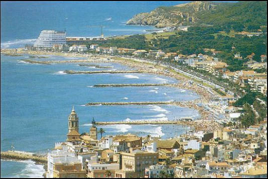
One unique facet of the Akogama shoreline is the artificial sandy beaches. These are created by thin concrete structures called groynes that extend into the river and block its flow, preventing erosion and trapping sand. These are most often seen as features of beaches that protect resorts (as seen below), but they are a unique feature of Nenova that make for quite a lovely park.
Several bridges cross the Akogama here. To prevent scour, or erosion by the abutments, it can be necessary to use wing dams- and they are seen here, north of Carther Bridge. To guide boats, there are dolphins (river buoys) in the river to prevent them from crashing into the bridge. These preventative measures are common in the real world.
Thanks for reading,
Jacob